WHO WE ARE

About Us

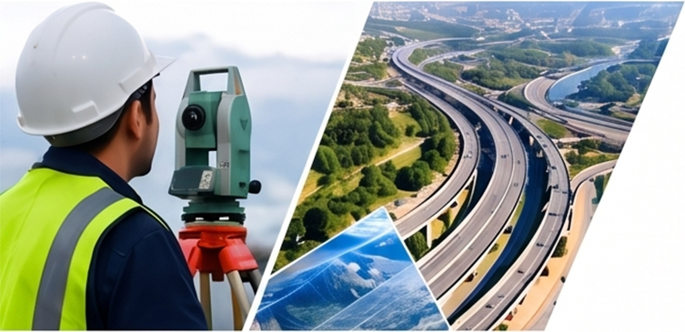
Hiwara Engineers field survey team

OUR STORY

Engineering Precision, Delivered With Purpose

Hiwara Engineers & Consultancy Pvt. Ltd. is a multidisciplinary engineering and geospatial consultancy based in Dehradun, Uttarakhand. Over the years we have built a reputation for combining strong civil engineering fundamentals with modern geospatial technology — GIS, LiDAR, drone surveys, and remote sensing — to give infrastructure, utility, and government projects the accuracy they need at every stage.

From highway DPRs and topographic surveys to 3D city modeling and land-use mapping, our team works across the full project lifecycle: field data capture, processing, analysis, and delivery of decision-ready reports and maps. We work with public sector bodies, infrastructure developers, and industry clients across Smart Cities, Highways, Railways, Power, Water Resources, and more.


50+Projects
100+Clients
5+Years
25+Experts

Our Mission

To deliver accurate, reliable, and technology-driven engineering and geospatial solutions that help our clients plan, build, and manage infrastructure with confidence — on time, and to the highest standard of precision.

Our Vision

To be a leading engineering and geospatial consultancy in India, recognized for innovation, integrity, and the quality of every deliverable — contributing to smarter, more sustainable infrastructure development nationwide.

WHAT DRIVES US

Our Core Values

Quality & Accuracy

Every deliverable is checked and validated against strict quality benchmarks.

Innovation & Technology

We invest in the latest GIS, LiDAR, and drone technology to stay ahead.

Integrity & Commitment

Transparent processes and honest reporting, on every project, every time.

Safety & Sustainability

Field operations and recommendations that prioritise safety and sustainability.

WHY CHOOSE US

A Team You Can Rely On

We combine experienced engineers, certified surveyors, and geospatial specialists with modern equipment and software to deliver work that stands up to scrutiny — on schedule, wherever the project is located.

Get In Touch
High Accuracy Deliverables

Rigorous QA/QC on every survey and dataset.

Advanced Technology

ArcGIS, LiDAR, drones, and modern processing software.

Experienced Professionals

Qualified civil engineers and geospatial specialists.

On-Time Delivery

Planned workflows that keep projects on schedule.

Pan India Services

Field teams mobilised for projects across the country.

Client-Centric Approach

Clear communication from proposal to final handover.

Have a Project in Mind?

Talk to our team about your engineering, survey, or geospatial requirement.

Get A Quote